World’s first micro-study on thunderstorm distribution has started“Thunderstorms could increase”
8 July 2020, by Hendrik Tieke and Christina Kraetzig

Photo: UHH/Ohme
Thunderstorms create cold regions that can lead to new thunderstorms Computer simulations can depict the effect, but what does it look like in nature? A research team at Universität Hamburg and the Max Planck Institute for Meteorology is now hot on the trail of this real-world phenomenon. It has over 100 measuring stations throughout the whole of Hamburg.
Mr. Ament, how do thunderstorms arise?
There are 3 ingredients: warm and humid air above Earth’s surface, the right temperatures at higher altitudes, and a catalyst.
The first ingredient, warm and humid air above Earth’s surface, appears above all in summer when the sun heats up the ground. When this happens, a lot of water evaporates. The warm summer air absorbs this water and leads to typically humid weather. The temperature decrease at high altitudes—the second ingredient—creates a barrier. In a thunderstorm situation, the barrier is not as pronounced as usual, which is why humid air can penetrate it.The third ingredient, the catalyst, is usually a random gust of wind. This lifts a humid package of air upwards through the barrier. Once the package arrives, the humidity condenses, which means that the water vapor cools down and drops form. A cloud forms that, thanks to the release of evaporative heat, can develop into a high-reaching, dark thundercloud.
The exciting thing about these clouds is that the falling rain can trigger the next generation of thunderstorms. So thunderstorms could increase!
How exactly does this happen?
Via “cold pools,” which you could translate as “cold air lakes.” Cold pools form because rain evaporates as it falls, cooling the surrounding air. Cold air is heavy and flows downwards. Thus, on the ground, a “lake” of cold air forms beneath the precipitation region and it flows outwards in all directions, just like water that someone pours on a flat plane.
If this heavy, cold air from the cold pool meets the humid air on the ground, it slips beneath the humid air and lifts the ground air. Then the whole thing starts over again: humid, warm air rises and a new thunderstorm forms.
How are cold pools measured?

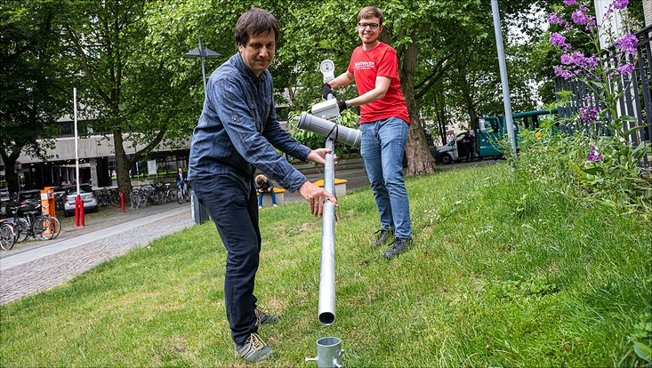
We use meters that we developed ourselves and that are attached to a pole 3 meters high; they measure the air temperature and air pressure every second. Standard weather stations record these measurements only every 10 minutes—far too seldom for quick cold pools that spread to the tune of 50 km per hour. Normally, the meters also stand far too far apart. It is only with our tightly-knit network of 100 stations that we can prevent a cold pool from escaping. This is new!
Why is it so important to research cold pools?
We have been studying cold pools in high-resolution computer simulations for a long time now. They are beautiful to watch in these computer animations and they have exciting effects that we understand quite well. But do they reflect reality? Do real cold pools really look like the cold pools on a computer? We are studying this now, with more stations than any research team has ever used before.
With the help of our measurements, we can improve weather and climate models. The data can thus also help us make more precise thunderstorm warnings, meaning if, when, and where they are likely to occur. And they help us answer questions about mid- and long-term climate changes, especially for extreme weather phenomena such as downpours and thunderstorms. Cold pools are just small cogs in the vast climate system, but they steer important aspects of our weather and climate.
Actually, the research was supposed to take place in Brandenburg, correct?
Yes. We wanted to set up our network of stations southeast of Berlin as part of a large measuring campaign at the Deutscher Wetterdienst observatory. The corona pandemic threw a wrench into the works. We had to respond quickly and we shifted the campaign at short notice to home office. In the last few weeks, the meters were built in Hamburg and the surrounding region, in private gardens or on city premises.
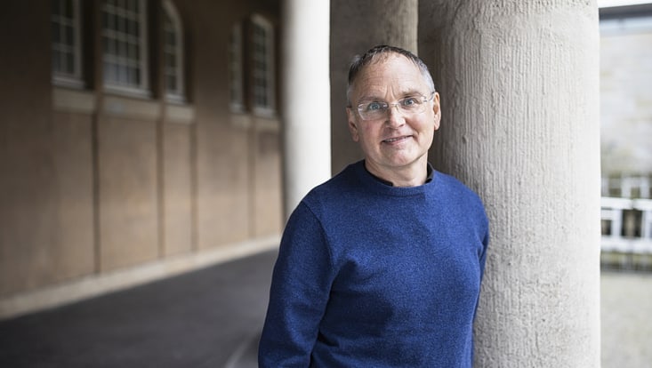
Dr. Felix Ament is a professor at Universität Hamburg’s Institute of Meteorology. He works on the development of weather and climate models at the Center for Earth System Research and Sustainability (CEN). He heads the Messkampagne FESST@HH, in which researchers from the Max Planck Institute for Meteorology are also involved. The Deutscher Wetterdienst is funding the project to the tune of roughly €1 million.


